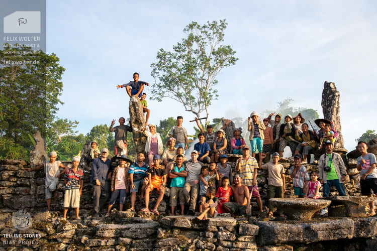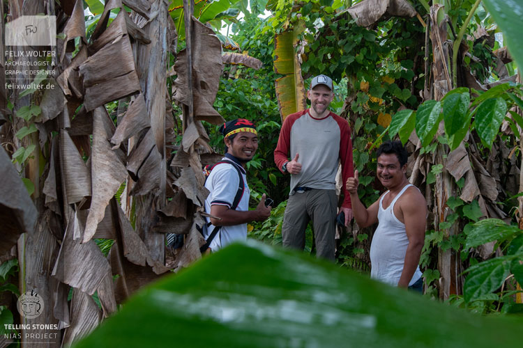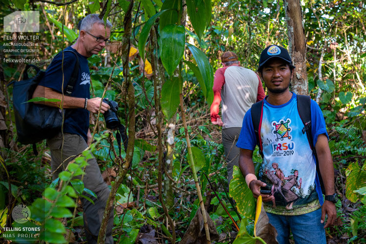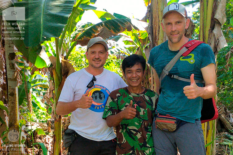
In spring 2020, I participated in a documentation project on Nias island, East of Sumatra (Indonesia). Under the direction of Prof. Dominik Bonatz and in close cooperation with the Nias Heritage Museum we carried out detailed documentation and mapping of several megalithic sites in Nias' Gomo valley.
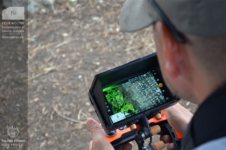
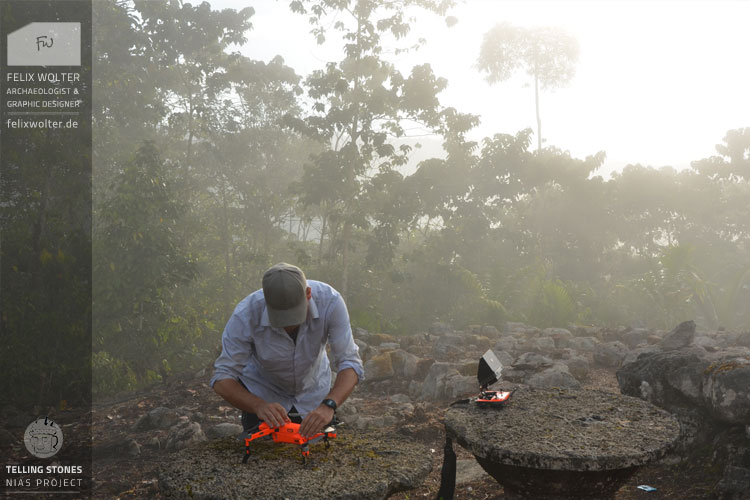
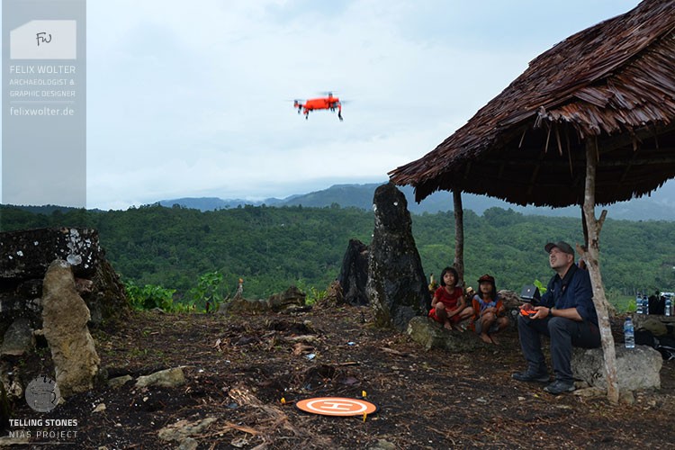
In the course of four weeks fieldwork, 17 megalithic sites were recorded in 3D - topographical models as well as 47 high-resolution individual models of chosen megalithic statues and ensembles. The sites were mapped with a camera drone, the individual statues were documented with HDR-photogrammetric 3D recordings with a handheld DSLR-camera.
The three major sites of this field campaign -
Tetegewo,
Tundrumbaho
and
Lahusa Satua
- were completely post-processed and can be visited virtually in 3D on the projects' interactive Sketchfab-page. The results and all recorded data were compiled in a detailed field work report and delivered to the projects' direction and its cooperation partners.
All Telling Stones 3D-models can be visited here on Sketchfab.
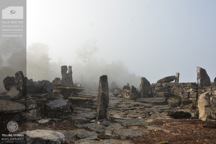
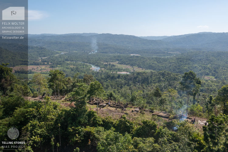
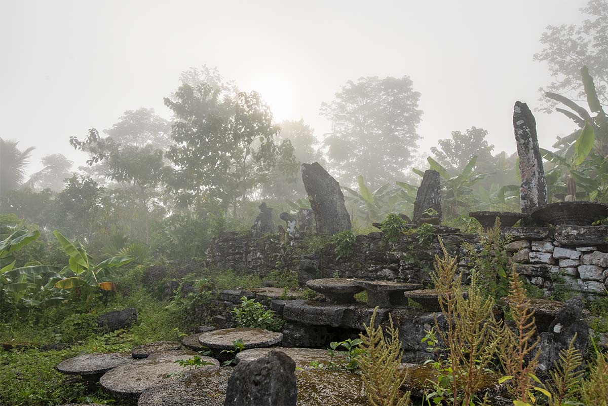
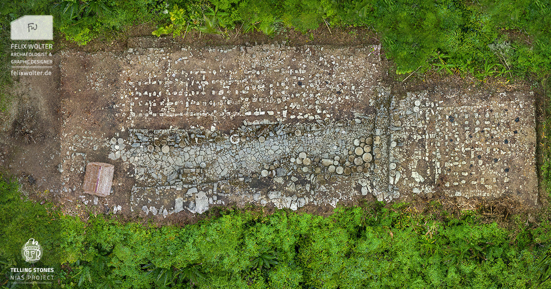
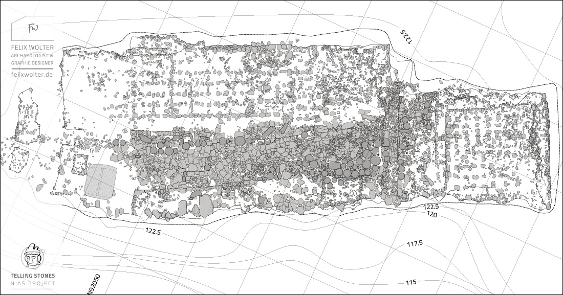
Three major sites in the Gomo Valley were mapped by drone and thoroughly documented by descriptions, measurements and detailed 3D-photogrammetry. The site of Tetegewo will be shown as an example here, but other sites can be explored via our sketchfab page. With the generous support of the local communities, the sites were freed from overgrowth, so that the full extension of the site became visible for the first time since long time ago.
By extensive drone flights high resolution 3D models were recorded. Those 3D-models were rectified and post-processed already during the mission. Inside the georeferenced topographic overview models precision of ~10 cm was reached. The resulting high-resolution ortho-image was used to draw a stone-by-stone CAD-plan of the whole site of Tetegewo.
On Tetewo we recorded two topographical plans and 8 individual statues. 3.149 Images were taken and ~17 mio. polygons were computed in the post-processing.
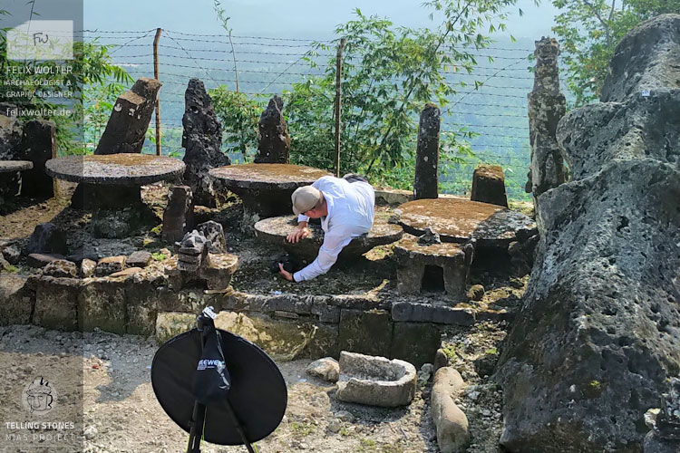
Tundrumbaho is one of the most prominent megalithic sites in the Gomo Valley. Additionally to the topographic recording of the site more than 10 megalith statues were documented in high detail by 3D-photogrammetry with a handheld DSLR camera.
This very precise 3D-models (< 5 cm error) can serve in the scientific research on the statues in different ways: Additionally to a detailed documentation of the current state of preservation, stonecutters' techniques, analyses as weight and workload calculations can be carried out, or the iconography of the statues can be studied.
On Tundrumbaho we recorded small and big scale topographical plans and 16 individual statues or fragments. 6.642 images were taken and ~29.1 mio. polygons were computed in the post-processing.
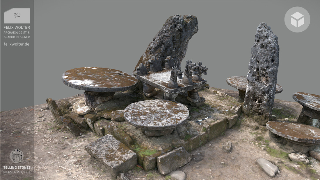
The osa-osa with three heads is a portable and figural stone seat for chieftains and noblemen. It is dressed into the shape of a three-headed lasara, a hybrid with mouth and tail of a bird, boars’ tusk and human ears with earrings.
© Text: J. Greger | Telling Stones Project
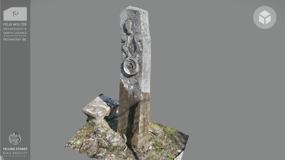
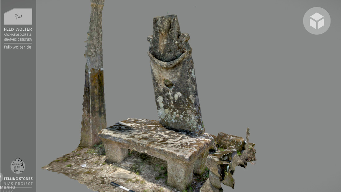
The behu represents the body of an ancestor. That one has the shape of the profile of a human head and it is decorated on each side with an ear and a rhombic earring with concentric pendant. This “ancestor” stands on the rock face and looks out over the valley.
© Text: J. Greger | Telling Stones Project
The behu represents the body of an ancestor. This anthropomorphic sculptured behu has a semioval bowl on the top. The purpose of the bowl is to hold a skull of a si’ulu (nobleman) on festive days. The traditional necklace of a headhunter is worked out from shoulder to shoulder.
© Text: J. Greger | Telling Stones Project
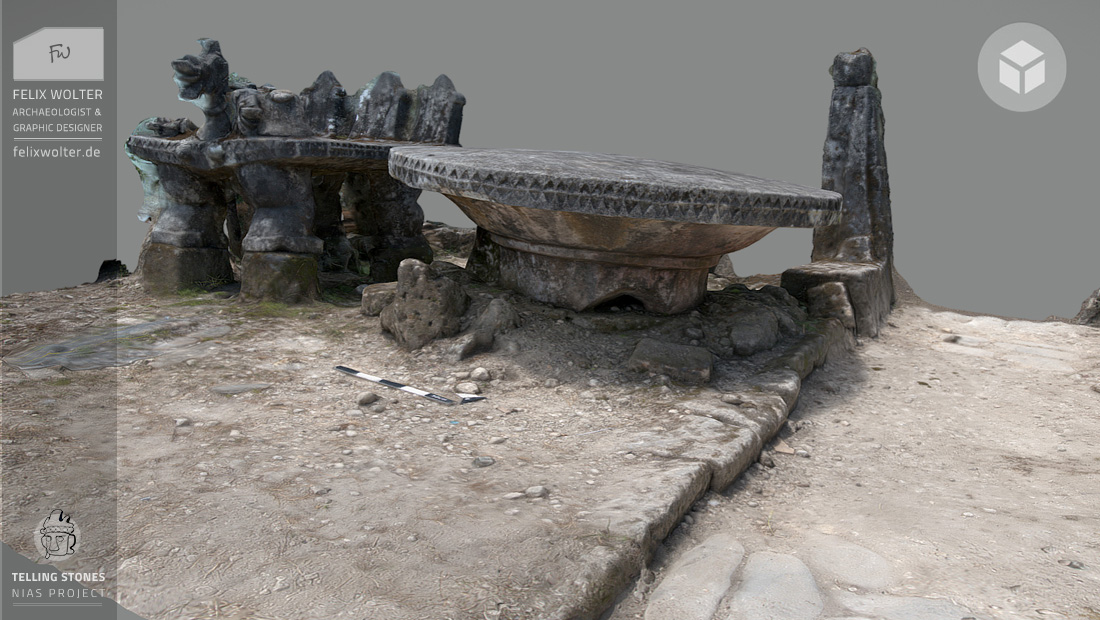
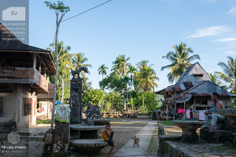
The gowe ni’ogazi is a round stone slab with a flat surface and a funnel-shaped bottom side on a cylindrical pedestal. It was made for the hostess of an owasa feast, a feast in her honor. She danced on her stone during the celebration and it made a sonorous sound.
© Text: J. Greger | Telling Stones Project
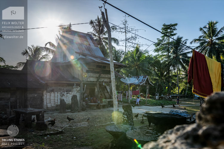
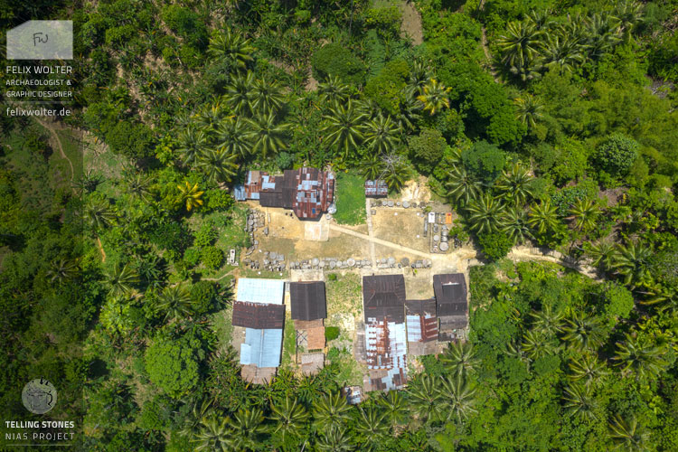
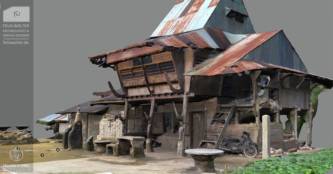
Additionally to the megalith macro and micro 3D-documentation, a few traditional heritage houses were documented during the field campaign. In the site of Lahusa Satua a so-called "chief’s house" was recorded. Lahusa Satua is a small village in the middle of the forest with an impressive ensemble of megalith statues.
This 3D-model can serve as a guideline for the estimation of a possible restauration of this heritage house and documents the current state of preservation of this - still inhabited - old wooden house. In front of the house several ancestor menhirs are placed, which were also recorded in high-resolution 3D-models.
In Lahusa Satua we recorded one overview plan and 8 individual statues. 2.600 Images were taken and ~29 mio. polygons were computed in the post-processing.
When the documentation mission and the post-processing of the recorded data was finished, a sorted and annotated data archive and a detailed report of activities was given to the Telling Stones Megalith Project.
These are the main benefits of 3D-data for the Telling Stones Project: