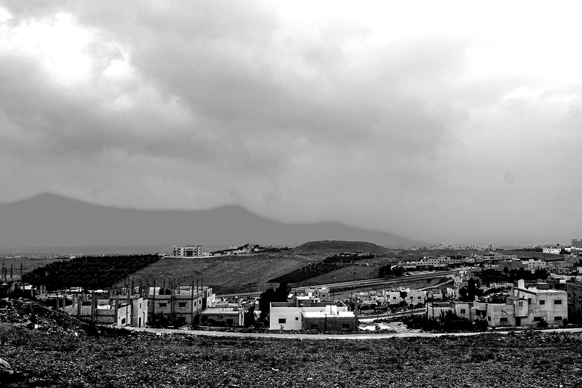
In summer 2021, I participated in the excavation of a Late Bronze Age fortress at Tell Ushayer, North of Irbid (Jordan). An archaeological team of the FU Berlin under the direction of Dominik Bonatz and the field supervision of Nathalie Kallas carried out excavations in two areas at the northern slope of the site.
My assignment at Tell Ushayer consisted in the setup of the surveying system, the stake-out and establishment of trenches, general locus and find surveying and the 3D-photogrammetric documentation of stone architecture.
Furthermore an extensive topographic mapping, a survey of architectural features visible on the surface of the mound and the establishment of ten long-term 'fixpoints' was carried out during the 6 weeks
of the 2021 campaign.
The 2021 excavations were not the first archaeological investigations at Tell Ushayer. Several survey-grade marks were established in 2019 during a geophysical survey by a team from Eastern Atlas. By use of my own high-precision GNSS equipment, we were able to find these monuments back immediately and attach to this pre-defined localization with a deviation below 1cm.
Based on the geomagnetic survey results and on the observation of stone architecture at the surface,
two excavation areas were defined by the projects' directors. These areas were detailed
in the GIS software and staked-out by RTK GNSS in the field. Already on Day 2 both trenches and their squares were established and the archaeological excavations at Tell Ushayer started.
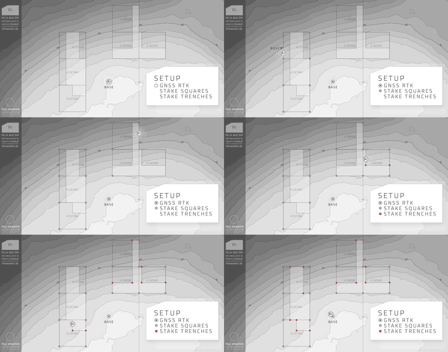 Stake-out of the Excavation Squares and Areas 2021
| © All rights reserved: Tell Ushayer Project
During the field mission, all archaeological features were documented by XYZ point and polyline measurements. This daily measurements were post-processed at the same working day and visualized in „daily sketch“ print-outs.
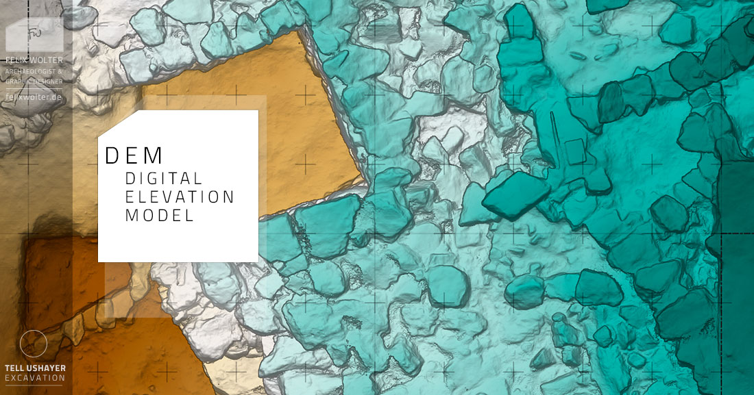
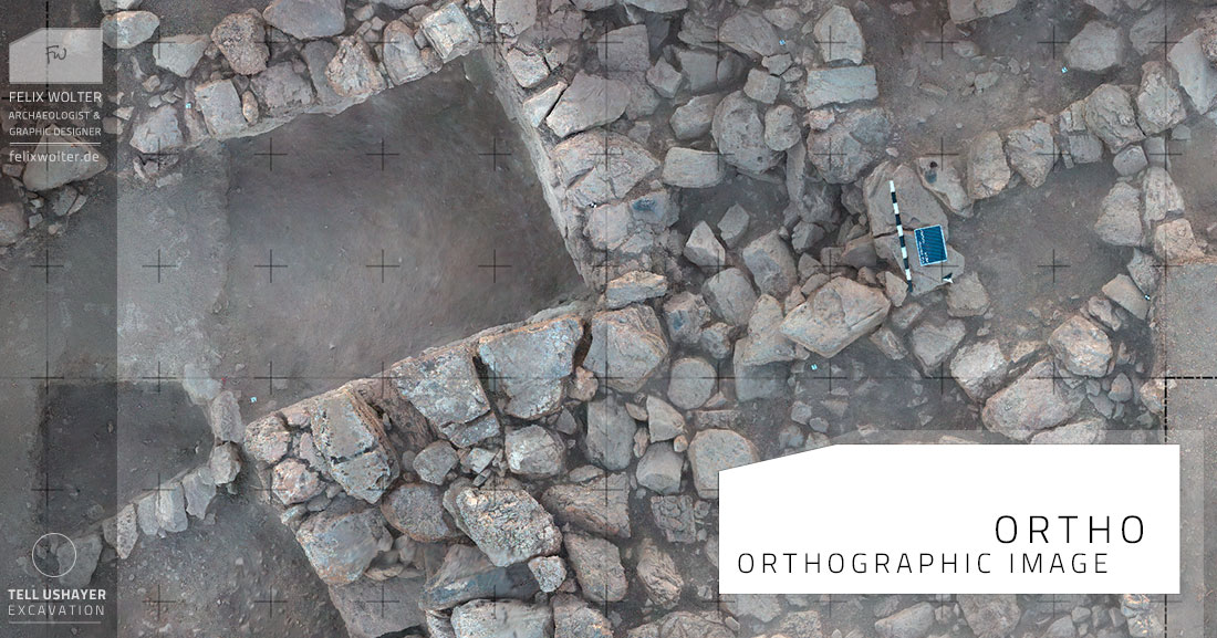
Important features, special findings and the final state of excavation were documented in high-resolution 3D-photogrammetric recordings. They serve as future reference - for measurements, visualization, stone-by-stone field drawings and detailed vectorisation.
The 3D-recordings - combined with the detailed field measurements - support the detailed analysis of the archaeological deposits and will assist the visualization and publication of the excavations' results.
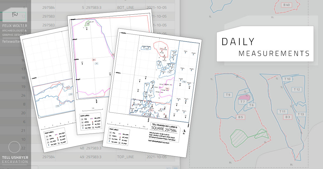 Tell Ushayer Daily Measurements
| © All rights reserved: Tell Ushayer Project
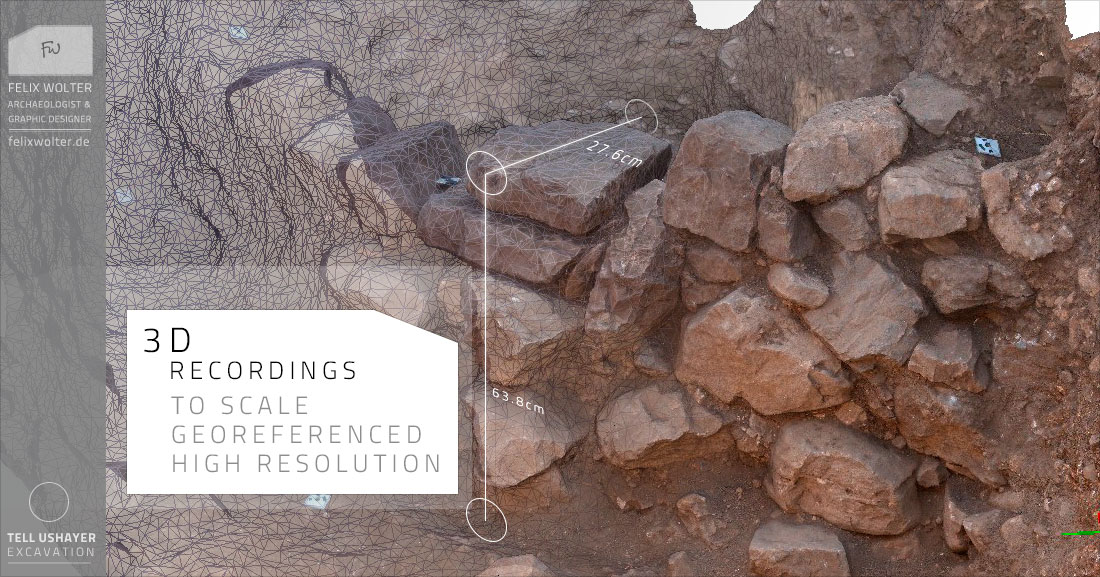 Tell Ushayer 3D Recordings
| © All rights reserved: Tell Ushayer Project
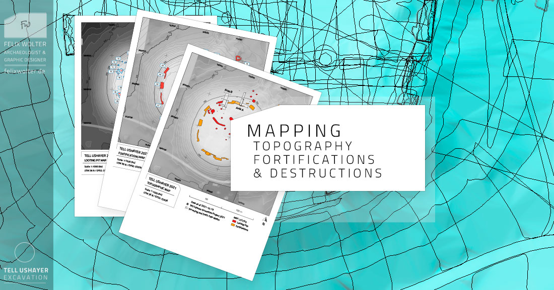
During the field campaign 2021 a topographic map was recorded. The site and its surroundings were surveyed: 28 km of trajectories were recorded, covering an area of ~ 8.5 hectar of rocky terrain and olive orchards. This topographic map is key for the presentation of the site, the planning of future excavations and for monitoring looting activities.
Many remains of the sites' Late Bronze Age fortification were observed at the surface of Tell Ushayer. While surveying the topography, additional architectural features were discovered and recorded by precise GNSS measurements. At the end of summer 2021, a complete and detailed map of all visible fortifications was completed.
 Tell Ushayer Mapping
| © All rights reserved: Tell Ushayer Project
My services supported the Tell Ushayer project with:
Speedy, smooth, and accurate geolocation setup of the excavations.
Detailed and high-precision 3D documentation and surveying of the dig.
Real-time surveying workflow in close cooperation with the excavators.
Topographic mapping of the site and its fortifications.
On-time delivery of all surveying results, ready to print.